| Author |
Message |
|
Freddy
Boss Gobbler
Joined: Fri Dec 03, 2004 12:50 pm
Posts: 3138
Location: Goodview, VA

|
 Scouting Tools? Just wondering if any of you guys use anything other than your memory for keeping up with scouting trips?
I use a 3-ring binder with arieal photos of my places. I slide them in a plastic cover and then use sharpy markers of different colors to show what I have seen/heard. I'll keep marking it up as the season goes on to show kills, in-season scouting, etc.
Here's a sample map and the legend I use...


The "roosted gobbler" and "gobbling turkey" are different based on whether I think the gobbler was heard on the roost or on the ground. If you plot a gobbler as he gobbles on the ground over several days you just have to connect the dots!  Like Bird Dog said, it's been so dry I haven't seen a turkey track in a while!
_________________
"You have to pay for every bird you kill and the coin you use to pay for them is time." - Tom Kelly
|
| Wed Mar 29, 2006 10:42 am |
 
|
|
|
Diablo
King of Spring
Joined: Mon Dec 06, 2004 11:46 am
Posts: 832
Location: SC by way of WV
|
Do you really need to ask me this question??!!  
You seen how pathological I am...and medication doesn't seem to do the trick.
Seriously, I use a similar approach and when you overlay year after year, trends become really obvious and almost predictable especially if the dirt you hunt has no significant changes (i.e. timbering, free roaming dogs, new farms construction, etc.)
Great post Freddy.
_________________
"A man who insists on adherence to the facts when it comes to his hunting exploits, size of fish...abilities of his bird dog...is an untrustworthy fellow. A fine sporting liar is a gentleman & someone whose acquaintance should be cherished" R. Ruark.
|
| Wed Mar 29, 2006 12:07 pm |
|
|
|
WVBOY
King of Spring
Joined: Fri Dec 03, 2004 1:33 pm
Posts: 3038
Location: Powhatan, VA
|
Freddy where are you getting the Aerial photos?? Google Earth?? Or some service like it?? I've just started playing around with Google Earth the freebie and noticed the photos are pretty outdated and grainy.. I was thinking about purchasing Google Earth Pro .. I hear it's better..
Just curious, as I would like to start something similar to what you guys are describing with my scouting.. right now it's all Memory and a few notes in my Hunting Diary..
_________________
RB
Take me Home Country Roads.
|
| Wed Mar 29, 2006 12:30 pm |
|
|
|
Gobblenow
Co-Owner/Dog Feeder
Joined: Mon Dec 06, 2004 10:20 am
Posts: 3806
|
Freddy, when someone else takes you huting to their places do you prepare a chart like this one you are showing us. Will you ever share it with the person who took you ? :>)
|
| Wed Mar 29, 2006 12:32 pm |
|
|
|
Freddy
Boss Gobbler
Joined: Fri Dec 03, 2004 12:50 pm
Posts: 3138
Location: Goodview, VA
|
I knew your response Diablo!
WVBoy... most of these pics came from the county GIS websites. I have found them on terraserver/topozone in the past as well. The county GIS sites are great but the pictures are sometimes outdated as well but i just make notes of the differences.
GN... if you provide the map, I can add the colors. You get me turned around on those back roads down there.
_________________
"You have to pay for every bird you kill and the coin you use to pay for them is time." - Tom Kelly
|
| Wed Mar 29, 2006 1:54 pm |
|
|
|
barry
King of Spring
Joined: Fri Mar 03, 2006 4:44 pm
Posts: 2720
Location: Bedford, VA
|
scouting tools Cool stuff Freddy, (notice that I'm spelling your name right now)
I'm still old school. I do keep a list of places that I can hunt. I have to, the older I get the more I FORGET and I would really hate to forget a good place.
barry
_________________
"Do not let what you can not do interfere with what you can do." - John Wooden
|
| Wed Mar 29, 2006 2:28 pm |
|
|
|
Dale
King of Spring
Joined: Sat Dec 04, 2004 9:27 am
Posts: 1907
Location: Roanoke, VA
|
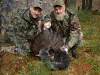
I can tell you from hunting with ol' Three Toes this fall that his maps are nothing short of amazing!
|
| Wed Mar 29, 2006 4:20 pm |

|
|
|
Fullback24
King of Spring
Joined: Thu Dec 30, 2004 12:34 pm
Posts: 456
Location: Trigg, VA
|
I do use the aerials and topo's, but haven't been marking them.....that's a good idea though that I think I'll put to practice.
|
| Thu Mar 30, 2006 1:39 am |
|
|
|
Charliedog
2 Year Old
Joined: Mon Dec 20, 2004 5:01 pm
Posts: 96
Location: Crozet, VA
|
That's a great idea. I use Tops and Aerieals to figure out how to legally (w/o trespassing) get to some spots where I have seen birds and to track further back in the Mnts if I need to, but never thought about marking spots on them. I have some weird areas that you have to take some pretty strange routes to get to efficiently AND legally. A good GPS works too.
|
| Thu Mar 30, 2006 12:42 pm |
|
|
|
FlatLand Gobbler
King of Spring
Joined: Mon Dec 06, 2004 8:46 am
Posts: 753
Location: Hampton, VA.
|
Cool idea Freddy. I used to do that when I fished lakes all the time. I'd mark structure and flats etc, and kept a diary of the details of my trips.
I have been keeping a journal for hunting but hadn't thought of marking a map like that.
Thanks for the idea.
_________________
Ron
"Turkey hunting, when you knock all the feathers off it, is a game of infinite variables, played on a field of unlimited dimension, against an opponent who doesn't know the rules and wouldn't play by them if he did." ...Jim Spencer
|
| Thu Mar 30, 2006 12:55 pm |
|
|
|
Limbhanger
King of Spring
Joined: Wed Mar 09, 2005 10:49 am
Posts: 331
|
All the info for this spring is stored between the ears so that it can't mistakenly fall into the wrong hands.  Fortunately it's already getting full up there! 
-Eric
_________________
Love those Limb Hangers!!!!
|
| Thu Mar 30, 2006 4:58 pm |
|
|
|
Turkenator
King of Spring
Joined: Fri Apr 22, 2005 11:28 pm
Posts: 333
Location: Wise County, VA
|
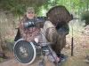
I think it's easy to see why Mr. McGuire is so successfull season after season.
I have been using topo's and aerials for a while now... but I never really got into detail like that with it. About the only thing I've done is marked different things I've noticed in the woods, that maybe wasn't on the map, that I wanted to make note of.
I believe I'll start doing something like this... great idea Freddy! 
|
| Thu Mar 30, 2006 5:28 pm |
|
|
|